Aerial Image Annotation for Insurance and Property Risk
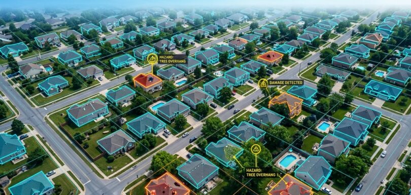
US property insurers are increasingly underwriting and settling claims with help from models that read aerial and satellite imagery. A carrier can assess a roof's condition before binding a policy, flag wildfire or flood exposure across a portfolio, or triage storm damage across a whole county without sending an adjuster to every address. None of […]